Junction, Texas: Difference between revisions
m Reverting vandalism |
copyedit, removed overlinking |
||
| Line 82: | Line 82: | ||
|population_est = 2404 |
|population_est = 2404 |
||
}} |
}} |
||
'''Junction''' is a city in and the [[county seat]] of [[Kimble County, |
'''Junction''' is a city in and the [[county seat|seat]] of [[Kimble County, Texas]], United States.<ref name="GR6">{{cite web|url=http://www.naco.org/Counties/Pages/FindACounty.aspx |accessdate=2011-06-07 |title=Find a County |publisher=National Association of Counties |url-status=dead |archiveurl=https://web.archive.org/web/20110531210815/http://www.naco.org/Counties/Pages/FindACounty.aspx |archivedate=2011-05-31 }}</ref> Its population was 2,574 at the [[2010 United States Census|2010 census]].<ref name="Census 2010">{{cite web| url=http://factfinder.census.gov/bkmk/table/1.0/en/DEC/10_SF1/G001/1600000US4838248| title=Geographic Identifiers: 2010 Census Summary File 1 (G001), Junction city, Texas| publisher=U.S. Census Bureau| work=American FactFinder| accessdate=May 9, 2019| archive-url=https://archive.today/20200213061230/http://factfinder.census.gov/bkmk/table/1.0/en/DEC/10_SF1/G001/1600000US4838248| archive-date=February 13, 2020| url-status=dead}}</ref> |
||
==Geography== |
==Geography== |
||
Junction is located at {{coord|30.489772|-99.771335|type:city_region:US|format=dms|display=inline}} (30.489772, -99.771335),<ref name="GR1">{{cite web|url=https://www.census.gov/geographies/reference-files/time-series/geo/gazetteer-files.html|publisher=[[United States Census Bureau]]|accessdate=2011-04-23|date=2011-02-12|title=US Gazetteer files: 2010, 2000, and 1990}}</ref> about {{convert|115|mi}} northwest of [[San Antonio]] and {{convert|140|mi}} west of [[Austin, Texas|Austin]] in central Kimble County.<ref>{{Cite web| url=https://google.com/maps| title=Junction, TX: Driving Directions| work=Google Maps| access-date=May 9, 2019}}</ref> [[Interstate 10]] runs through the northern and eastern parts of the city, with access from Exits 456 and 457. I-10 leads southeast {{convert|52|mi}} to [[Kerrville, Texas|Kerrville]] and beyond to San Antonio, and west {{convert|57|mi}} to [[Sonora, Texas|Sonora]]. [[U.S. Route 83]] follows I-10 past Junction, leading north {{convert|31|mi}} to [[Menard, Texas|Menard]] and south {{convert|102|mi}} to [[Uvalde, Texas|Uvalde]]. [[U.S. Route 377]] passes through the center of Junction as Main Street and 11th Street. To the northeast |
Junction is located at {{coord|30.489772|-99.771335|type:city_region:US|format=dms|display=inline}} (30.489772, -99.771335),<ref name="GR1">{{cite web|url=https://www.census.gov/geographies/reference-files/time-series/geo/gazetteer-files.html|publisher=[[United States Census Bureau]]|accessdate=2011-04-23|date=2011-02-12|title=US Gazetteer files: 2010, 2000, and 1990}}</ref> about {{convert|115|mi}} northwest of [[San Antonio]] and {{convert|140|mi}} west of [[Austin, Texas|Austin]] in central Kimble County.<ref>{{Cite web| url=https://google.com/maps| title=Junction, TX: Driving Directions| work=Google Maps| access-date=May 9, 2019}}</ref> [[Interstate 10]] runs through the northern and eastern parts of the city, with access from Exits 456 and 457. I-10 leads southeast {{convert|52|mi}} to [[Kerrville, Texas|Kerrville]] and beyond to San Antonio, and west {{convert|57|mi}} to [[Sonora, Texas|Sonora]]. [[U.S. Route 83]] follows I-10 past Junction, leading north {{convert|31|mi}} to [[Menard, Texas|Menard]] and south {{convert|102|mi}} to [[Uvalde, Texas|Uvalde]]. [[U.S. Route 377]] passes through the center of Junction as Main Street and 11th Street. To the northeast, U.S. 377 leads {{convert|45|mi}} to [[Mason, Texas|Mason]], and to the southwest it leads {{convert|46|mi}} to [[Rocksprings, Texas|Rocksprings]]. |
||
According to the [[United States Census Bureau]], Junction has a total area of {{convert|6.0|km2|order=flip}}, of which {{convert|0.02|km2|order=flip|2}}, or 0.26%, |
According to the [[United States Census Bureau]], Junction has a total area of {{convert|6.0|km2|order=flip|abbr=on}}, of which {{convert|0.02|km2|order=flip|2}}, or 0.26%, is covered by water.<ref name="Census 2010"/> The city is named for its location at the confluence of the North and South [[Llano River]]s.<ref name="Texas Handbook">{{cite web | url = https://tshaonline.org/handbook/online/articles/hgj05 | title = Junction, Texas | work = | publisher = [[The Handbook of Texas]] online | date = | accessdate = 2009-06-06}}</ref> |
||
==History== |
==History== |
||
| Line 96: | Line 96: | ||
[[Image:Junction, TX, swimming pool IMG 4344.JPG|200px|left|thumb|Municipal swimming pool in Junction]] |
[[Image:Junction, TX, swimming pool IMG 4344.JPG|200px|left|thumb|Municipal swimming pool in Junction]] |
||
The community was founded in 1876 after the organization of Kimble County earlier that year.<ref name="Texas Handbook"/> The original town site was named "Denman" after Marcellus Denman, who had surveyed and platted the new community. The name was quickly changed to "Junction City". In late 1876, Junction City won the designation of county seat from the unsuccessful and flood-prone settlement of Kimbleville. By 1879, a drugstore, livery stable, sawmill, and a few general stores were active in the community. Around 300 people were living in Junction City in 1882. The ''West Texas'', Kimble County's first newspaper, began publishing in 1882. The county courthouse and its records were lost to a fire in 1884. A second, two-story brick stone courthouse was partially destroyed in an 1888 fire, but was repaired and remained in use until 1929, when the present courthouse was constructed. In 1894, Junction City became known simply as "Junction".<ref name="Texas Handbook"/> Infrastructure improvements marked the decade of the 1890s. Businessman Ernest Holekamp provided the city's first waterworks with a canal dug from the South Llano to Junction in 1895. A dam was built in 1896 on the South Llano River to provide power and water to the city and irrigation to surrounding lands. |
The community was founded in 1876 after the organization of Kimble County earlier that year.<ref name="Texas Handbook"/> The original town site was named "Denman" after Marcellus Denman, who had surveyed and platted the new community. The name was quickly changed to "Junction City". In late 1876, Junction City won the designation of county seat from the unsuccessful and flood-prone settlement of Kimbleville. By 1879, a drugstore, livery stable, sawmill, and a few general stores were active in the community. Around 300 people were living in Junction City in 1882. The ''West Texas'', Kimble County's first newspaper, began publishing in 1882. The county courthouse and its records were lost to a fire in 1884. A second, two-story brick and stone courthouse was partially destroyed in an 1888 fire, but was repaired and remained in use until 1929, when the present courthouse was constructed. In 1894, Junction City became known simply as "Junction".<ref name="Texas Handbook"/> Infrastructure improvements marked the decade of the 1890s. Businessman Ernest Holekamp provided the city's first waterworks with a canal dug from the South Llano to Junction in 1895. A dam was built in 1896 on the South Llano River to provide power and water to the city and irrigation to surrounding lands. |
||
The population stood at 536 in 1900. Four Mile Dam, a more permanent and extensive dam, was completed in 1904. Junction continued to grow rapidly, with around 800 residents living in the community in 1910. That figure had grown to 1,250 by 1920. By the late 1920s, citizens felt the need for the benefits of a municipal government.<ref name="Kimble Chamber 1">{{cite web | url = http://www.junctiontexas.net/junctionbeginning.html | title = Junction - A New Beginning | work = | publisher = Kimble County Chamber of Commerce | date = | accessdate = 2009-06-06}}</ref> On August 27, 1927, H.O. Denman and 152 others presented an incorporation petition to Kimble County Judge J.B. Randolph. In the election, 390 votes were cast: 274 (70%) "For Incorporation" and 116 (30%) "Against Incorporation". A city officers' election took place on October 13, 1927, with Ernest Holekamp elected as Junction's first mayor.<ref name="Kimble Chamber 1"/> |
The population stood at 536 in 1900. Four Mile Dam, a more permanent and extensive dam, was completed in 1904. Junction continued to grow rapidly, with around 800 residents living in the community in 1910. That figure had grown to 1,250 by 1920. By the late 1920s, citizens felt the need for the benefits of a municipal government.<ref name="Kimble Chamber 1">{{cite web | url = http://www.junctiontexas.net/junctionbeginning.html | title = Junction - A New Beginning | work = | publisher = Kimble County Chamber of Commerce | date = | accessdate = 2009-06-06}}</ref> On August 27, 1927, H.O. Denman and 152 others presented an incorporation petition to Kimble County Judge J.B. Randolph. In the election, 390 votes were cast: 274 (70%) "For Incorporation" and 116 (30%) "Against Incorporation". A city officers' election took place on October 13, 1927, with Ernest Holekamp elected as Junction's first mayor.<ref name="Kimble Chamber 1"/> |
||
During the mid-1920s, highway connections from Junction to |
During the mid-1920s, highway connections from Junction to Menard and [[San Angelo, Texas|San Angelo]] were made available. A sewer system was built in 1929. In the 1930 census, the city recorded 1,415 residents. Junction was the chief shipping and commercial center of Kimble County, as well as a tourist resort and hunting center. A new municipal building and fire station were opened in 1939 and 1940, respectively. In the mid-1940s, the cedar-oil business enhanced the economy, but the city's growth slowed.<ref name="Texas Handbook"/> Throughout the latter half of the 20th century and into the 21st, Junction's population continued to hover around 2,600. |
||
==Demographics== |
==Demographics== |
||
| Line 140: | Line 140: | ||
[[Image:Church of Christ, Junction, TX IMG 4342.JPG|200px|right|thumb|Church of Christ in Junction]] |
[[Image:Church of Christ, Junction, TX IMG 4342.JPG|200px|right|thumb|Church of Christ in Junction]] |
||
Notable highways serving the city include |
Notable highways serving the city include Interstate 10, U.S. Route 83, and U.S. Route 377.<ref name="Kimble Chamber 2"/> |
||
[[Kimble County Airport]] consists of a {{convert|5000|ft|m|adj=on}} paved runway. Commercial service is available from [[Mathis Field]] in San Angelo. |
[[Kimble County Airport]] consists of a {{convert|5000|ft|m|adj=on}} paved runway. Commercial service is available to and from [[Mathis Field]] in San Angelo. |
||
Electric power for the city of Junction is provided by [[American Electric Power|AEP/West Texas Utilities]], while member-owned [[Pedernales Electric Cooperative|Pedernales Electric]] distributes power to rural Kimble County. |
Electric power for the city of Junction is provided by [[American Electric Power|AEP/West Texas Utilities]], while member-owned [[Pedernales Electric Cooperative|Pedernales Electric]] distributes power to rural Kimble County. |
||
| Line 155: | Line 155: | ||
==Notable people== |
==Notable people== |
||
*[[Les Cox]], former [[Major League Baseball]] player |
*[[Les Cox]], former [[Major League Baseball]] player |
||
*[[Clinton Manges]], [[South Texas]] businessman, spent some of his impoverished childhood in Junction where his grandfather renovated mattresses.<ref>{{cite magazine |
*[[Clinton Manges]], [[South Texas]] businessman, spent some of his impoverished childhood in Junction, where his grandfather renovated mattresses.<ref>{{cite magazine |
||
|title=The Man in the Black Hat |magazine=[[Texas Monthly]] |date=June 1984 |accessdate=2013-09-09 |
|title=The Man in the Black Hat |magazine=[[Texas Monthly]] |date=June 1984 |accessdate=2013-09-09 |
||
|authorlink=Paul Burka |first=Paul |last=Burka |
|authorlink=Paul Burka |first=Paul |last=Burka |
||
| Line 161: | Line 161: | ||
|quote=His family moved south to Junction, where his grandfather renovated mattresses; young Clinton rode with him from ranch to ranch to pick up old bedding.}}</ref> |
|quote=His family moved south to Junction, where his grandfather renovated mattresses; young Clinton rode with him from ranch to ranch to pick up old bedding.}}</ref> |
||
*[[Andrew Murr]] (grandson of Coke Stevenson), current [[Republican Party (United States)|Republican]] member of the [[Texas House of Representatives]] from Kimble County, and the former [[county judge]] |
*[[Andrew Murr]] (grandson of Coke Stevenson), current [[Republican Party (United States)|Republican]] member of the [[Texas House of Representatives]] from Kimble County, and the former [[county judge]] |
||
*[[Coke Stevenson]], [[governor of Texas]] from 1941 to 1947, was a native of Junction. A meeting hall north of |
*[[Coke Stevenson]], [[governor of Texas]] from 1941 to 1947, was a native of Junction. A meeting hall north of Interstate 10 is named in his honor. Stevenson lost to [[Lyndon B. Johnson]] the 1948 [[US Senate]] [[Democratic Party (United States)|Democratic]] [[primary election|primary]] [[runoff election]] by 87 disputed votes. |
||
==Attractions== |
==Attractions== |
||
[[Image:Downtown Junction, TX IMG 4330.JPG|200px|left|thumb|A |
[[Image:Downtown Junction, TX IMG 4330.JPG|200px|left|thumb|A view of downtown Junction, with the defunct Texan Theater at the left]] |
||
Major celebrations in Junction include the Billie Sale and Parade held in August, and the annual Kimble Kow Kick, which takes place in September.<ref name="Texas Handbook"/> |
Major celebrations in Junction include the Billie Sale and Parade held in August, and the annual Kimble Kow Kick, which takes place in September.<ref name="Texas Handbook"/> |
||
The Kimble County Historical Museum contains documents, tools, and other relics from the days of early settlers and military artifacts. The [[O.C. Fisher]] Museum, housed in the Kimble County Library, contains an exact duplicate of the [[Washington, DC]], office of the long-time congressman who represented the Junction area. |
The Kimble County Historical Museum contains documents, tools, and other relics from the days of early settlers and military artifacts. The [[O.C. Fisher]] Museum, housed in the Kimble County Library, contains an exact duplicate of the [[Washington, DC]], office of the long-time congressman who represented the Junction area. |
||
Junction is home to several parks, including the {{convert|2,600|acre|km2|adj=on}} [[South Llano River State Park]]. |
Junction is home to several parks, including the {{convert|2,600|acre|km2|adj=on}} [[South Llano River State Park]]. It also has eight swimming pools, golf and tennis courts, and abundant hotel/motel options due mainly to its location along the heavily traveled Interstate 10 corridor.<ref name="Kimble Chamber 2"/> The [[Fort McKavett State Historic Site]] is also located near Junction. |
||
The [[Fort McKavett State Historic Site]] is also located near Junction. |
|||
==Miscellaneous== |
==Miscellaneous== |
||
| Line 178: | Line 176: | ||
==Climate== |
==Climate== |
||
The climate in this area is characterized by hot, humid summers and generally mild to cool winters. According to the [[Köppen climate classification]] |
The climate in this area is characterized by hot, humid summers and generally mild to cool winters. According to the [[Köppen climate classification]], Junction has a [[humid subtropical climate]], ''Cfa'' on climate maps.<ref>[http://www.weatherbase.com/weather/weather-summary.php3?s=13237&cityname=Junction%2C+Texas%2C+United+States+of+America&units= Climate Summary for Junction, Texas]</ref> |
||
==References== |
==References== |
||
Revision as of 02:48, 6 April 2021
Junction, Texas | |
|---|---|
 Junction City Hall | |
| Nickname(s): | |
 | |
 Junction, Texas Location of Junction, Texas | |
| Coordinates: 30°29′23″N 99°46′17″W / 30.48972°N 99.77139°W | |
| Country | United States |
| State | Texas |
| County | Kimble |
| Government | |
| • Mayor | Russell Hammonds |
| Area | |
| • Total | 2.30 sq mi (5.96 km2) |
| • Land | 2.29 sq mi (5.94 km2) |
| • Water | 0.01 sq mi (0.02 km2) |
| Elevation | 1,709 ft (521 m) |
| Population (2010) | |
| • Total | 2,574 |
| • Estimate (2019)[5] | 2,404 |
| • Density | 1,048.41/sq mi (404.84/km2) |
| Time zone | UTC-6 (Central (CST)) |
| • Summer (DST) | UTC-5 (CDT) |
| ZIP code | 76849 |
| Area code | 325 |
| FIPS code | 48-38248[6] |
| GNIS feature ID | 1374333[4] |
| U.S. Routes | |
| Interstates | |
| Website | cityofjunction |
Junction is a city in and the seat of Kimble County, Texas, United States.[7] Its population was 2,574 at the 2010 census.[8]
Geography
Junction is located at 30°29′23″N 99°46′17″W / 30.489772°N 99.771335°W (30.489772, -99.771335),[9] about 115 miles (185 km) northwest of San Antonio and 140 miles (230 km) west of Austin in central Kimble County.[10] Interstate 10 runs through the northern and eastern parts of the city, with access from Exits 456 and 457. I-10 leads southeast 52 miles (84 km) to Kerrville and beyond to San Antonio, and west 57 miles (92 km) to Sonora. U.S. Route 83 follows I-10 past Junction, leading north 31 miles (50 km) to Menard and south 102 miles (164 km) to Uvalde. U.S. Route 377 passes through the center of Junction as Main Street and 11th Street. To the northeast, U.S. 377 leads 45 miles (72 km) to Mason, and to the southwest it leads 46 miles (74 km) to Rocksprings.
According to the United States Census Bureau, Junction has a total area of 2.3 sq mi (6.0 km2), of which 0.01 square miles (0.02 km2), or 0.26%, is covered by water.[8] The city is named for its location at the confluence of the North and South Llano Rivers.[11]
History


The community was founded in 1876 after the organization of Kimble County earlier that year.[11] The original town site was named "Denman" after Marcellus Denman, who had surveyed and platted the new community. The name was quickly changed to "Junction City". In late 1876, Junction City won the designation of county seat from the unsuccessful and flood-prone settlement of Kimbleville. By 1879, a drugstore, livery stable, sawmill, and a few general stores were active in the community. Around 300 people were living in Junction City in 1882. The West Texas, Kimble County's first newspaper, began publishing in 1882. The county courthouse and its records were lost to a fire in 1884. A second, two-story brick and stone courthouse was partially destroyed in an 1888 fire, but was repaired and remained in use until 1929, when the present courthouse was constructed. In 1894, Junction City became known simply as "Junction".[11] Infrastructure improvements marked the decade of the 1890s. Businessman Ernest Holekamp provided the city's first waterworks with a canal dug from the South Llano to Junction in 1895. A dam was built in 1896 on the South Llano River to provide power and water to the city and irrigation to surrounding lands.
The population stood at 536 in 1900. Four Mile Dam, a more permanent and extensive dam, was completed in 1904. Junction continued to grow rapidly, with around 800 residents living in the community in 1910. That figure had grown to 1,250 by 1920. By the late 1920s, citizens felt the need for the benefits of a municipal government.[12] On August 27, 1927, H.O. Denman and 152 others presented an incorporation petition to Kimble County Judge J.B. Randolph. In the election, 390 votes were cast: 274 (70%) "For Incorporation" and 116 (30%) "Against Incorporation". A city officers' election took place on October 13, 1927, with Ernest Holekamp elected as Junction's first mayor.[12]
During the mid-1920s, highway connections from Junction to Menard and San Angelo were made available. A sewer system was built in 1929. In the 1930 census, the city recorded 1,415 residents. Junction was the chief shipping and commercial center of Kimble County, as well as a tourist resort and hunting center. A new municipal building and fire station were opened in 1939 and 1940, respectively. In the mid-1940s, the cedar-oil business enhanced the economy, but the city's growth slowed.[11] Throughout the latter half of the 20th century and into the 21st, Junction's population continued to hover around 2,600.
Demographics

| Census | Pop. | Note | %± |
|---|---|---|---|
| 1890 | 449 | — | |
| 1930 | 1,415 | — | |
| 1940 | 2,086 | 47.4% | |
| 1950 | 2,471 | 18.5% | |
| 1960 | 2,441 | −1.2% | |
| 1970 | 2,654 | 8.7% | |
| 1980 | 2,593 | −2.3% | |
| 1990 | 2,654 | 2.4% | |
| 2000 | 2,618 | −1.4% | |
| 2010 | 2,574 | −1.7% | |
| 2019 (est.) | 2,404 | [5] | −6.6% |
| U.S. Decennial Census[13] | |||
As of the census[6] of 2000, 2,618 people, 1,028 households, and 699 families resided in the city. The population density was 1,145.0 people per square mile (441.4/km2). The 1,222 housing units averaged 534.5 per square mile (206.0/km2). The racial makeup of the city was 86.13% White, 0.04% African American, 0.38% Native American, 0.69% Asian, 11.12% from other races, and 1.64% from two or more races. Hispanics or Latinos of any race were 28.99% of the population.
Of the 1,028 households, 35.4% had children under the age of 18 living with them, 52.3% were married couples living together, 12.1% had a female householder with no husband present, and 32.0% were not families. About 29.6% of all households were made up of individuals, and 16.9% had someone living alone who was 65 years of age or older. The average household size was 2.50 and the average family size was 3.11.
In the city, the population was distributed as 28.2% under the age of 18, 7.3% from 18 to 24, 24.4% from 25 to 44, 22.0% from 45 to 64, and 18.1% who were 65 years of age or older. The median age was 38 years. For every 100 females, there were 85.9 males. For every 100 females age 18 and over, there were 82.4 males.
The median income for a household in the city was $25,833, and for a family was $30,865. Males had a median income of $24,096 versus $18,750 for females. The per capita income for the city was $14,971. About 16.4% of families and 21.7% of the population were below the poverty line, including 30.9% of those under age 18 and 16.8% of those age 65 or over.

Government
The city of Junction is a "Type A" General Law municipality under Texas law. The local government is headed by an elected mayor and five-member city council.
The Junction Economic Development Corporation, Tourism Board, and Chamber of Commerce are given the task of attracting jobs and visitors to Junction while supporting local business establishments.[14]
Infrastructure


Notable highways serving the city include Interstate 10, U.S. Route 83, and U.S. Route 377.[14]
Kimble County Airport consists of a 5,000-foot (1,500 m) paved runway. Commercial service is available to and from Mathis Field in San Angelo.
Electric power for the city of Junction is provided by AEP/West Texas Utilities, while member-owned Pedernales Electric distributes power to rural Kimble County.
A four-member police force and county sheriff officers serve the community. The 30-member volunteer fire department, as well as the Kimble County Ranch Fire Association, has firefighting personnel and equipment. Ambulance and rescue services are also provided.[14]
Education
Public education in the city of Junction is provided by the Junction Independent School District. The district supports an elementary, middle, and high school housed on a single campus at 1700 College Street.
Junction is home to the Texas Tech University Center at Junction, a satellite school of Texas Tech University in Lubbock. The center is situated on a 410-acre (1.7 km2) campus, and offers a broad spectrum of programs in both the undergraduate and graduate disciplines.[14]
Notable people
- Les Cox, former Major League Baseball player
- Clinton Manges, South Texas businessman, spent some of his impoverished childhood in Junction, where his grandfather renovated mattresses.[15]
- Andrew Murr (grandson of Coke Stevenson), current Republican member of the Texas House of Representatives from Kimble County, and the former county judge
- Coke Stevenson, governor of Texas from 1941 to 1947, was a native of Junction. A meeting hall north of Interstate 10 is named in his honor. Stevenson lost to Lyndon B. Johnson the 1948 US Senate Democratic primary runoff election by 87 disputed votes.
Attractions

Major celebrations in Junction include the Billie Sale and Parade held in August, and the annual Kimble Kow Kick, which takes place in September.[11]
The Kimble County Historical Museum contains documents, tools, and other relics from the days of early settlers and military artifacts. The O.C. Fisher Museum, housed in the Kimble County Library, contains an exact duplicate of the Washington, DC, office of the long-time congressman who represented the Junction area.
Junction is home to several parks, including the 2,600-acre (11 km2) South Llano River State Park. It also has eight swimming pools, golf and tennis courts, and abundant hotel/motel options due mainly to its location along the heavily traveled Interstate 10 corridor.[14] The Fort McKavett State Historic Site is also located near Junction.
Miscellaneous
While coaching at Texas A&M University, Paul "Bear" Bryant's 10-day summer football camp was held in Junction in 1954. The "Junction Boys" was the nickname given to those who made it through the entire camp. The event was described by Jim Dent in his book, The Junction Boys (published in 2000) and was portrayed in an ESPN television film.
Climate
The climate in this area is characterized by hot, humid summers and generally mild to cool winters. According to the Köppen climate classification, Junction has a humid subtropical climate, Cfa on climate maps.[16]
References
- ^ City of Junction, Texas - Official site.
- ^ "Junction, Texas". Texas Escapes Online Magazine. Retrieved 2009-06-05.
- ^ "2019 U.S. Gazetteer Files". United States Census Bureau. Retrieved August 7, 2020.
- ^ a b U.S. Geological Survey Geographic Names Information System: Junction, Texas
- ^ a b "Population and Housing Unit Estimates". United States Census Bureau. May 24, 2020. Retrieved May 27, 2020.
- ^ a b "U.S. Census website". United States Census Bureau. Retrieved 2008-01-31.
- ^ "Find a County". National Association of Counties. Archived from the original on 2011-05-31. Retrieved 2011-06-07.
- ^ a b "Geographic Identifiers: 2010 Census Summary File 1 (G001), Junction city, Texas". American FactFinder. U.S. Census Bureau. Archived from the original on February 13, 2020. Retrieved May 9, 2019.
- ^ "US Gazetteer files: 2010, 2000, and 1990". United States Census Bureau. 2011-02-12. Retrieved 2011-04-23.
- ^ "Junction, TX: Driving Directions". Google Maps. Retrieved May 9, 2019.
- ^ a b c d e "Junction, Texas". The Handbook of Texas online. Retrieved 2009-06-06.
- ^ a b "Junction - A New Beginning". Kimble County Chamber of Commerce. Retrieved 2009-06-06.
- ^ "Census of Population and Housing". Census.gov. Retrieved June 4, 2015.
- ^ a b c d e "About Junction". Kimble County Chamber of Commerce. Archived from the original on 2009-06-17. Retrieved 2009-06-06.
- ^ Burka, Paul (June 1984). "The Man in the Black Hat". Texas Monthly. Retrieved 2013-09-09.
His family moved south to Junction, where his grandfather renovated mattresses; young Clinton rode with him from ranch to ranch to pick up old bedding.
- ^ Climate Summary for Junction, Texas
External links
- Official website
- Junction Eagle - weekly newspaper
- Junction Independent School District
- Kimble County Tourism Board
- Kimble County Chamber of Commerce
- Junction, Texas Economic Development Corporation
- Junction, Texas from the Handbook of Texas Online
- U.S. Geological Survey Geographic Names Information System: Junction, Texas
Municipalities and communities of Kimble County, Texas, United States | ||
|---|---|---|
| City | 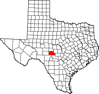 | |
| Town | ||
| Unincorporated community | ||
| Ghost towns | ||
| International | |
|---|---|
| National | |